
Trace a Christiansburg Street Route
Use an address as the starting point, not as proof of a household. The Montgomery County Commissioner of Revenue connects an address to a tax-map parcel and current assessed owner. The deed index then connects the owner and durable land description to recorded transfers. A lawful voter route or a historical directory may add a separate, limited address clue, but neither replaces the parcel record. This Christiansburg street directory workflow keeps the meaning of each record clear.
- Enter the physical address in the Montgomery property address search. Save the situs address, tax-map number, legal description, and assessed owner.
- Open the same parcel in MyGIS OneView to check the street segment, parcel shape, address points, and nearby parcels.
- Search the assessed owner as a grantee in the Montgomery land-record index. Match the legal description before treating an instrument as part of the chain.
- For voter information, use the Virginia Citizen Portal only for its self-service status and polling-place functions, or ask the Elections Office about a lawful request under the voter-list rules. It is not a free street roster.
- For an older address, compare the 1932 directory and newspaper material with the parcel and deed trail. The historical volumes are described in the Christiansburg city directory collections.
Each stop answers a narrower question. A parcel card identifies an assessed owner; a deed documents a recorded transaction; a directory or newspaper can offer an era-specific listing. Keep the source date beside each note.
Christiansburg Address Search Fields
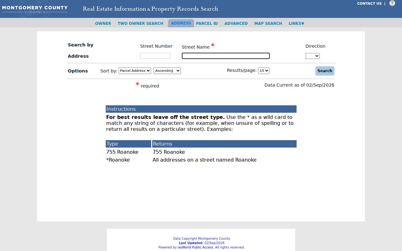
The Commissioner portal is the practical first stop for an address search along a Christiansburg street. Its address mode accepts an optional street number and requires a street name. The county’s own tip is especially helpful: omit the street type. Leave the number blank to browse a street, then add it when the result set needs narrowing. A wildcard also works, so *Roanoke returns street-name matches. That is more reliable than guessing whether a record uses Street, Road, or another suffix.
| Portal field | Input | Needed? | Christiansburg use |
|---|---|---|---|
| Street Number | Text | No | Use a number to narrow, or leave blank to browse a street. |
| Street Name | Text | Yes | Omit street type. Wildcards are accepted, including *Roanoke. |
| Direction | Dropdown | No | Portal-generated choices can refine a directional street name. |
| Sort by | Dropdown | No | Controls result order; current choices were not captured in the research. |
| Results per page | Dropdown | No | Changes pagination size; current choices were not captured. |
| Search | Button | Yes | Runs the address query. |
The Montgomery address-search screen is shown below. It illustrates the address-first route for a Christiansburg street search.
Read returned parcels individually. A street name can appear in nearby jurisdictions, and a matching address still needs a parcel and legal-description check.
Note: Copy the tax-map number exactly as returned before moving between the assessor, map, and Clerk records.
Map a Christiansburg Street Segment
MyGIS OneView adds the street geometry that a property-search result lacks. Its Search Bar accepts an address, street range, or parcel ID. Turn on the parcel and address layers, then zoom until the layer controls display the features needed for the segment. Pop-up arrows move through overlapping results. The viewer also offers an Advanced Parcels Query for at least one criterion, drawing tools, measurements, print and share controls, and selection tools for parcels or address points.
For a Christiansburg street directory task, click a parcel first and record its identifier. Rectangle or grouping selection can collect several parcels and address points, and the result list may export a CSV or create a separate layer. That export is a working list, not an official ownership roll. Verify every selected parcel on the Commissioner card and every ownership change in the Clerk’s index. MyGIS parcel data are updated monthly, but the county labels the viewer reference-only rather than a legal record.
Montgomery’s property map search provides another map-oriented county record view for the Christiansburg street-search process.
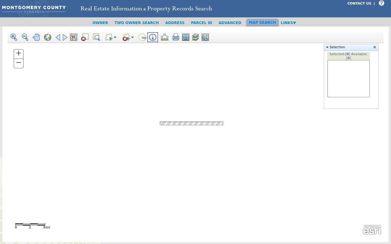
Use the map result to locate a parcel and then confirm its tax-map number in the Commissioner portal. Map placement alone does not establish ownership or current presence.
Christiansburg Street Record Coverage
The useful records for a Christiansburg street search are all address-keyed in different ways. The assessor is centered on assessed ownership. MyGIS centers the parcel and road geometry. The Clerk centers recorded instruments and legal descriptions. Municipal permits can document address-specific work when a record is public. Historical directories and newspaper results offer dated listings rather than a continuous account. The table keeps those roles separate.
| Source | Street-level field | Best question | Access or limit |
|---|---|---|---|
| Assessor address mode | Street number, name, direction, parcel result | Which assessed parcels match this street? | Free search; omit street type for best results. |
| Assessor owner mode | Owner, parcel, mailing and situs addresses | Who is the assessed owner? | Owner is not every person at a parcel. |
| MyGIS OneView | Address and parcel geometry, layers, selection | Which parcels lie on this segment? | Free, monthly updates, reference-only. |
| Circuit land index | Grantor, grantee, instrument, legal description | Who conveyed or encumbered a parcel? | Online and office routes; images vary. |
| Town GeoWeb | Streets, addresses, county tax parcels | How does the municipal map depict the street? | Free map; extra data may be requested by email. |
| Voter list or portal | Address, name, and district under controlled access | Which eligible registered records relate to an address or precinct? | Use is restricted; no ballot choices. |
| Permits and town files | Address and public work or case details | What documented work occurred there? | Digital system began in 2025; historical fields are unverified. |
| Historic directories and OCR | Address, person, business, event terms | Who was listed in a particular era? | 1932 directory is verified; OCR and reverse-directory coverage vary. |
The parcel number and legal description carry a record from the map to deeds and plats. The street name helps with browsing, but it is often absent from older recorded instruments.
Read a Christiansburg Parcel Card
A parcel card is a tax and assessment record, not a census. The portal advertises a tax-map number, owner name, owner mailing address, situs or property address, legal description, land size, assessment, residential sketch, and any listed exemption or classification. The owner spelling can differ from a deed or historical directory. The assessment is shown at fair-market value for the county’s assessment system, so it should not be recast as a private profile.
- Parcel
- A mapped unit of land identified by a tax-map number. It links the assessor record, GIS feature, plats, and deeds.
- Situs address
- The physical address where a parcel lies. It is the right starting field for a street search.
- Plat
- A recorded map that translates a lot, phase, section, or acreage description into street geography.
- Criss-cross directory
- An address-oriented directory section that can point from a street number to a dated listing, if that section exists for the year.
A mailing address tells the tax office where correspondence goes. It can be outside Christiansburg or outside Virginia, and it should never be presented as proof that the owner lives at the situs. The same caution applies to a tax-exemption field, which can be a clue but is not conclusive occupancy evidence.
Follow a Christiansburg Street Deed Chain
For a Christiansburg street directory ownership trail, begin with the assessed owner and legal description, then search the owner as grantee in the Circuit Clerk’s land index. A grantee receives an interest, while a grantor transfers one. Read the instrument entry or image when access permits, note the seller, recording date, book and page or instrument number, and compare the legal description with the parcel. Next, search that seller as grantee to find the earlier purchase. Repeat the sequence rather than relying on a matching street spelling.
Montgomery records begin in 1777. Earlier Fincastle County material covers 1773 through 1777. SRA/COVERS can provide statewide index access where available, and Logan or a Clerk visit may be needed for images. The precise online image cutoff was not stated in the research, so an office visit, LVA catalog search, microfilm, FamilySearch, and the Clerk copy route remain part of an older-address search. The Clerk’s index also records easements, plats, assignments, satisfactions, deeds of trust, powers of attorney, foreclosure deeds, and related instruments. Not all describe a sale.
The Circuit Clerk’s deeds and land-records page identifies the recorded instrument types and index practices used in this step.

The index is a bridge to the record, not a substitute for checking the matching parcel description. For copies, the Clerk lists ordinary copies at $0.50 per page and a certification addition of $2 per document.
Use Plats for Christiansburg Streets
Street numbers sometimes disappear in an older deed. In that case, search the land description that survives the address change: town or district, subdivision, lot, phase, section, acreage, and map references. The Clerk advises choosing the relevant town or district rather than both. A plat can show the lot arrangement that lets a researcher compare an older description to a current parcel, especially where parcels split or combine.
The advanced property search can support the current end of this work with criteria such as value range, acreage, sale-date month or year, zoning, tax district, neighborhood, year built, and exemption class. At least one criterion is required, and the research did not capture every current dropdown choice. Treat unverified controls as a reason to inspect the live screen, not as a reason to guess.
The county advanced property search is the source shown here for the Christiansburg street-record workflow.
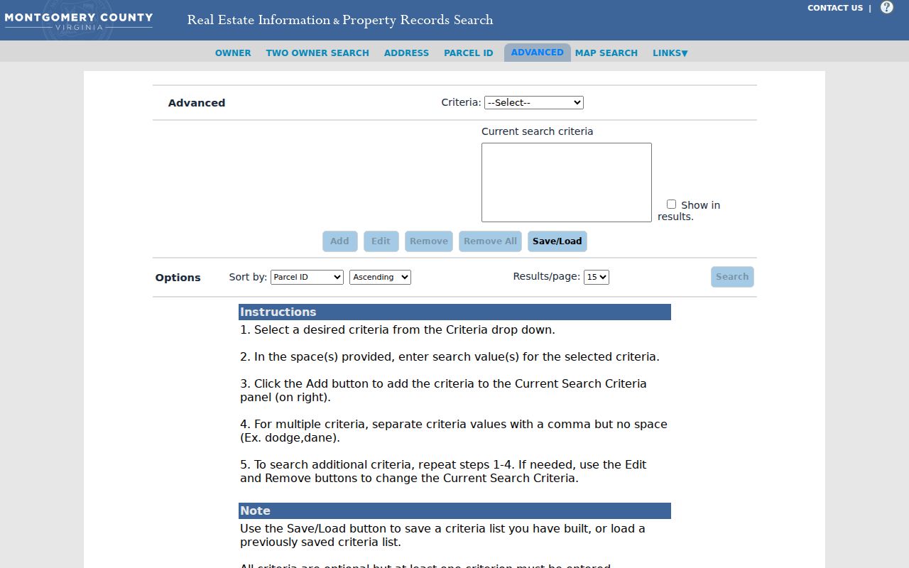
Use any advanced result as a way to identify a parcel, then verify the returned legal description and deeds through the official custodians.
Cross, Franklin, and Cambria Streets
Older Christiansburg street research needs historical terms. Early town references use Main and Cross Streets, and present Franklin Street was formerly Cross Street. Cambria developed around the railroad and Cambria Depot, then consolidated with Christiansburg on December 31, 1965. A person can therefore appear under Cambria in an older directory or newspaper and under Christiansburg later without a recorded move.
Search both versions of a street or place name, then use the parcel and legal description to decide whether the records concern the same land. Cambria terms such as Depot, Station, Front, Hall, Holmes, Sunnyside, and railroad can also be useful newspaper and deed-index keywords when a surname is unclear. No town-wide street-renumbering year was verified, so a specific renumbering claim would be unsupported.
Note: Preserve the spelling and place heading used by the historical record before adding a modern cross-reference in notes.
Christiansburg Street Voter Limits
Virginia’s free voter-information portal is primarily a self-service status and polling-place route. It is not an unrestricted tool for searching a whole Christiansburg street. Under Virginia Code §§24.2-405 and 24.2-444, qualifying public registrar lists can include specified fields such as name, address, year of birth, gender, and election districts. The law also limits eligible recipients and bars online publication or sharing with unauthorized parties.
Do not infer party affiliation, ballot choice, or who physically lives at an address from a voter-related result. Full birth dates, Social Security numbers, and protected residence information are not public list fields. The Virginia Address Confidentiality Program can limit disclosure for qualifying participants, and a suppressed address must not be reconstructed from map, tax, court, or mailing records.
Christiansburg Street Permit Fallback
In a Christiansburg street directory search, address-keyed permit material can help date construction, alteration, or inspection activity, but it does not prove a transfer or current presence. Christiansburg’s Permit Applications page documents a digital Plans/Permits system with 24/7 self-service, introduced in 2025, while Building Inspections still provides an in-person route at Town Hall. The research did not verify public historical-search fields, so do not assume an account dashboard is a public archive.
Ask Building Inspections or submit a focused Town of Christiansburg public-record request for an existing permit by address. Identify the wanted permit number, type, applicant or owner, issue or final date, inspection status, and attachments if public. Virginia FOIA applies to existing town records, subject to exemptions; it does not require the town to create a new street list.
Christiansburg Street Search Boundaries
A Christiansburg street search cannot identify every person connected with a parcel. Public assessment records center on owners, not every household member or non-owner occupant. Utility customer lists are not a public substitute for an address roster. DMV information is restricted by the federal Driver’s Privacy Protection Act and Virginia law, and a town request cannot override those restrictions or create a new compilation of people.
Lawful use. Use Christiansburg address records for personal, lawful research such as family history, property history, or civic questions. Do not use names, map exports, obituaries, or public files to stalk, harass, intimidate, or locate a protected person.
Virginia’s stalking statute, Va. Code §18.2-60.3, and computer-harassment rules set real limits on misuse. When a record is protected, stop at the custodian’s boundary.