
Christiansburg Neighbors by Block Source
Public sources describe parcels, recorded owners, and community geography in different ways. Montgomery County MyGIS is the place to see the block, while the Commissioner of Revenue card provides the assessed owner, situs, mailing address, tax-map number, legal description, and assessment facts for one parcel. The Circuit Court Clerk's land index is the source for a recorded transfer. None of these official records is a complete list of people at a home, so treat ownership and occupancy as separate questions.
| Source | What It Shows About a Block | Access |
|---|---|---|
| MyGIS OneView | Parcel boundaries, addresses, adjacent parcels, and map layers | Free viewer; selection and export are reference-only |
| Commissioner portal | Assessed owner, mailing and situs addresses, parcel facts, and legal description | Free parcel-by-parcel search; not all occupants |
| Town GeoWeb | Municipal streets, addresses, tax parcels, and town map layers | Free map; extra data may be requested by email |
| Montgomery land index | Recorded instruments and prior owners for a specific parcel | Online index and Clerk route; image access varies |
| Controlled voter list | Specified voter fields for lawful recipients | Virginia statutory eligibility and no-publication limits |
| Historic and community sources | District geography, newspaper, yearbook, and voluntary contact context | Map, library, Museum, or private contact route |
For a Christiansburg block, a tax card identifies an assessed owner, not every adult, guest, renter, or household member. The address also may be a mailing address for tax correspondence rather than the parcel's situs. The full named-street chain belongs on the Christiansburg street directory; a block search stays with the immediate parcels around one address.
MyGIS for Christiansburg Neighbors
Montgomery County MyGIS OneView provides the practical starting point for a Christiansburg block. Search by address, street range, or parcel ID, turn on the parcel and address-point layers, and click the target. Pop-up arrows move through overlapping map features. The guide also documents polygon, line, point, and text drawing tools, a measurement tool, and an Advanced Parcels Query with criteria such as owner, value, acreage, sale date, zoning, tax district, neighborhood, year built, and exemption class.
The Montgomery County GIS office describes MyGIS as the current viewer and notes that county parcel data are updated monthly.
The map helps place a parcel among its surroundings, but its reference-only disclaimer means it is not a legal survey or the final ownership record.
- Enter the target address, street range, or parcel ID and verify the highlighted parcel.
- Turn on parcel boundaries and address points, then use zoom and the pop-up arrows to inspect contiguous parcels.
- Use rectangle or grouping selection for the immediate block. Select parcels and address points separately when both map layers matter.
- Export the selected results only as a working list, then verify each parcel in the Commissioner record and a recorded transfer in the Clerk index.
MyGIS can export a selected group to CSV or a separate layer. That export is not an official ownership roll, and it can become stale. Note: Verify a selected Christiansburg parcel in the assessor card and Clerk record before relying on an owner name.
Confirming a Christiansburg Parcel Owner
After selecting a parcel, move to the Commissioner portal using the tax-map or parcel identifier exactly as returned. The portal offers owner, address, parcel ID, and advanced search modes. A typical card supplies the owner name, mailing address, situs, legal description, acreage, assessment, and sometimes a residential sketch or exemption classification. A homestead or exemption clue does not prove current occupancy. Nor does the mailing address replace the physical parcel address shown on the map.
The Montgomery parcel-ID search is the official card route after a map selection.
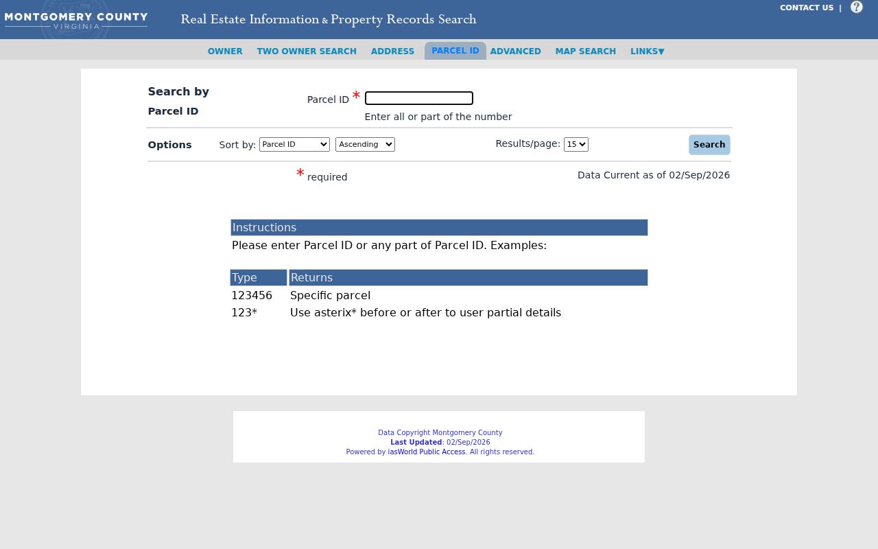
Copy the returned tax-map number and legal description rather than inventing a parcel format for the next search.
For a transfer check, search the assessed owner as grantee in the Montgomery land-record index. Read the recorded instrument for the grantor, date, book or instrument number, and legal description. A legal description uses durable land language such as town or district, subdivision, lot, phase, section, acreage, or plat reference. It is the bridge when a street number is absent or a parcel has changed shape.
Christiansburg Neighbors and Block Layers
Map layers add physical context without identifying a household. MyGIS can display zoning, flood, tax-district, road, imagery, and E911 layers around a Christiansburg parcel. Town GeoWeb and the Town GIS page provide streets, addresses, county tax parcels, solid-waste, storm drainage, street lighting, water and wastewater distribution, plus static zoning, flood or watershed, and future-land-use maps. Layer visibility can change with zoom, so check the legend before assuming a missing line or boundary means it is absent.
Zoning and district labels explain how the block is mapped or regulated. They do not establish who lives there. A Christiansburg postal address may also reach a Montgomery County parcel outside the town corporate limits, so use the town or county map to test the boundary. The GIS office can handle custom map requests through its form process; the research notes that some requests may take at least five business days.
Voter Records for Christiansburg Neighbors
Virginia voter information has a firm boundary. The free Virginia Citizen Portal is primarily a self-service status and polling-place tool, not a block-wide person search. Va. Code §§24.2-405 and 24.2-444 govern qualifying voter-list access and the fields that may appear. A controlled list can include name, address, year of birth, gender, and election district, while Social Security numbers, full birth dates, protected addresses, and other nonpublic registration material are excluded.
A qualifying recipient cannot post a voter list online in searchable form or give it to an unauthorized third party. A list cannot show every person at an address, whether someone is currently home, or how anyone voted. At a Christiansburg block, district and precinct information is civic context, not a household directory. Protected participants must remain protected, and the local Elections Office is the route for current access questions.
Christiansburg Neighbors and Historic Districts
Cambria, downtown Christiansburg, East Main, and South Franklin are the four historic districts identified on the town's Historic Resources material. They are geographic historic-resource districts, not membership lists. That distinction matters when reading a block map or researching a long-standing address. A historic-district label can suggest a local setting, but it cannot identify present residents or create a community roster.
| Official or commercial category | What it can support | What it cannot establish |
|---|---|---|
| Official parcel, tax, deed, and map records | Parcel geography, assessed ownership, and recorded land history | Every person connected with a home or current occupancy |
| Commercial neighbor-search category | A lead that may need checking against a custodian record | An official, complete, or error-free account of a block |
| Historic district map | Geographic and historic-resource context | A private association roster or a household list |
The official records are better for a narrow, documented parcel question. Commercial sources can be stale or merge similar names, so compare any lead with the Commissioner and Clerk records. A historic district remains a map designation, not a list of people.
Windsor Estates Community Contact
Windsor Estates is the one verified private association in the research. Its public contact page provides a directory-update route and mailing address, but it does not establish that a complete membership list is public. Use the contact route only for voluntary association information and do not treat the association as a government records custodian. No official town-wide association directory or umbrella page was found, and no general civic or block-watch roster was verified as a public database.
| Contact route | Known public information | Access |
|---|---|---|
| Windsor Estates contact page | P.O. Box 1331, Christiansburg, VA 24068, with a Directory Update route | Private association contact page; no public roster claim |
For older civic connections, MFRL, the Museum, newspapers, church archives, and yearbooks may contain intentionally published material. Search by a school, organization, street, or event, then confirm a name with its date and original source.
Cambria Block Geography
Cambria gives a Christiansburg block a compact historic map frame. The town's UDA material describes 114 parcels in 39 acres within the corporate limits and names streets including Brown, Rigby, Plum, King, Trent, Church, Driscoll, Cambria, Montgomery, Acorn, Bank, Wilson, Depot, Station, Holmes, Shaffer, Hall, Front, East Main, High, and Sunnyside. Those names can help locate a block or form a careful historic newspaper or deed query.
Cambria consolidated with Christiansburg on December 31, 1965. Earlier records can therefore use Cambria when later documents say Christiansburg, without proving a move. Main and Cross Street are another label trap: present Franklin Street was formerly Cross Street. Search both names and follow the parcel number or legal description when an address label changes. This is geography, not evidence of who lives on the block today.
Privacy Limits for Christiansburg Neighbors
Private and protected data remain outside a neighbor search. Public parcel tools do not list non-owner occupants, household members, utility customers, delivery records, DMV data, or protected residence information. Federal DPPA and Virginia DMV law restrict driver and vehicle records. Town or county FOIA cannot override those statutes, vital-record confidentiality, sealed court rules, or the Virginia Address Confidentiality Program. Do not attempt to reconstruct a suppressed address from other records.
Virginia's Address Confidentiality Program, Va. Code §2.2-515.2, provides a designated address and mail-forwarding protection for qualifying people. Va. Code §18.2-60.3 addresses stalking. A name, map, obituary, tax card, or voter record must never be used to repeatedly contact, threaten, follow, or expose a person. Note: Ask the specific custodian how to correct a public record rather than copying an error into a block list.
Lawful use. Use block-level Christiansburg records for personal, lawful research and geography. Respect protected records and never use an address, map export, or public name to harass, intimidate, or harm anyone.